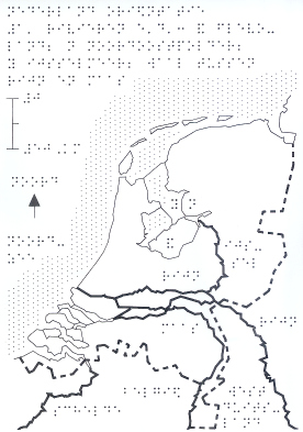
Realistic outline, waterways, neighboring countries
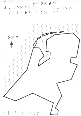
"From now on this formalized map will be used."
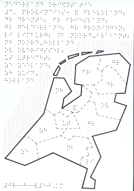
Provinces
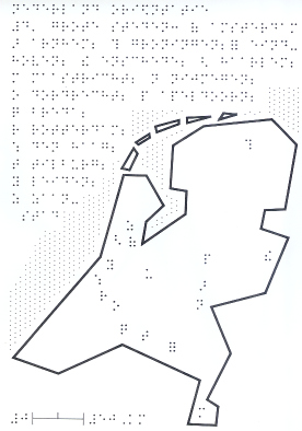
Major cities
Braille pictures ¼ size
| Realistic outline, waterways, neighboring countries |
"From now on this formalized map will be used." |
| Provinces |
Major cities |
These maps provide the blind reader with information that the
sighted reader already has, and the formalized map
that will be used for the rest of the book is introduced.
Examples on the next page.
go to first page, previous page, or next page
© 1989, 2002 Marco Schuffelen All Rights Reserved